Wednesday 15th October
Tuesday followed the trend of recent days under the dome of continuous thick cloud, although there was glimmer of sunshine at 09.15 when the sun broke through very briefly and I observed a very small patch of blue sky that promptly disappeared. That was disappointing as I had hoped this was an indication that the cloud would thin and break up as the morning progressed, but no such luck. The UV level was slightly higher than on Monday at 1.1 and the high solar of 223W/m2 was also slightly higher, but not that one would notice. Not surprisingly, the temperatures were depressed by day with a maximum of only 12.4C, which was logged at midnight, 00.00, Monday into Tuesday, before the thermometer fell away to around 10.4C at 08.00 and levelled out at around 11C for much of the day and early evening before reaching a low of 8.9C at 07.31 early Wednesday. An unusual pattern for temperature at this time of year. The high was 2.5C below average whilst the low was 1.5C above average thanks to the cloud cover once again. There brief bouts of very light drizzle from time to time during daylight hours, but not measurable, hence logged as a ‘trace’.
Wednesday again arrived dull and gloomy under thick, low cloud. Just before 07.00 the detailed radar indicated an area of broken, light precipitation developing over our area that continued past 08.30, about the time I finished writing this report. Looking at my record of detailed meteorological data I noticed that the temperature at 07.00 began to fall very slowly to reach a low of 8.9C, which was very close to the Dew Point temperature of 8.1C. Dew Point, meteorologically, is the point at which the moisture in the atmosphere condenses and cannot be held any longer and then begins to form precipitation, hence the very light drizzle this morning at that time, referred to as a trace in the records as so minimal it was not measurable.
The high pressure that has dominated ur weather since last Friday will be with is for perhaps three more days before it begins to fill and ease any. The significant change will arrive on Sunday when there is a possibility of precipitation as the weather fronts that the anticyclone has been fending off this week, begin to make progress over the UK. Therefore, it is likely that it will be fine and dry for the ‘Big’ Mop Fair on Saturday.
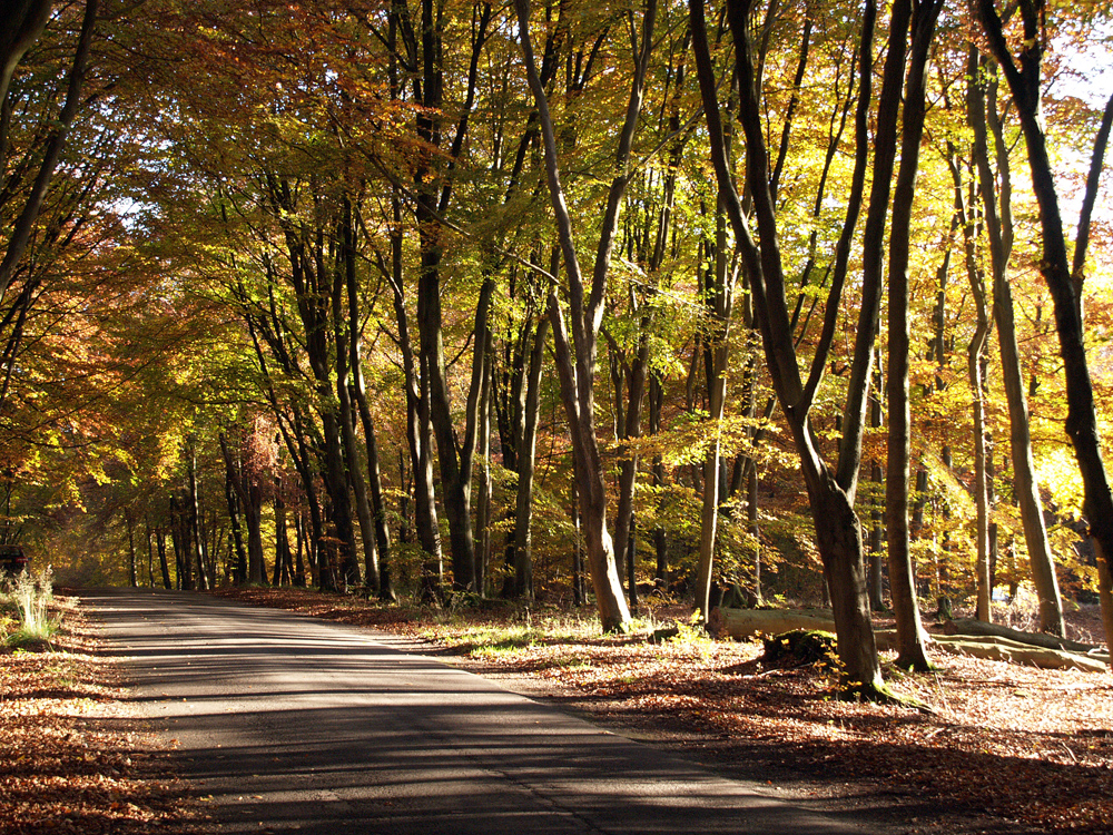
Savernake Forest. A particular impressive sight in the forest is the Grand Avenue of tall 200-year old beech trees illustrated in my photograph.