Monday 2nd November
The weak, cold front took its time to clear late evening on Sunday that gave us a very murky, gloomy day with the fog and low cloud reluctant to clear until well after midday. The breeze from the northeast was light but felt cool, which combined with the cloud meant a high of only 9.2C. The maximum did not occur during the daytime as is usual, but just after midnight at 00.22 as the damp weather and cold front eased away.The temperature then began to fall registering a low of 5.1C at 08.00. The high was 1.1C below average whilst the low was exactly 1.0C above average.
The arrival of Monday was much brighter with weak sunshine attempting to break through thin, high cloud that resulted in the temperature beginning to rise again. The breeze today will consistently come from a north-northeasterly direction, a cool direction that also heralds a slightly drier atmosphere, thus no fog or mist this morning with the humidity at 08.00 down a little to 94%, after the highs of 97% last week.
The large area of high pressure, now centred over Scotland, will dominate the rest of this week as the forecast pressure charts indicate it will be reluctant to leave the UK, just a slight reorientation towards the end of the week, when the breeze is likely to have a more easterly component. This consistency will see the breeze build higher than the recent very calm days and continue to come from a northeasterly or north-northeasterly direction, however, both maximum and minimum temperatures until Friday, will be close to the November average.
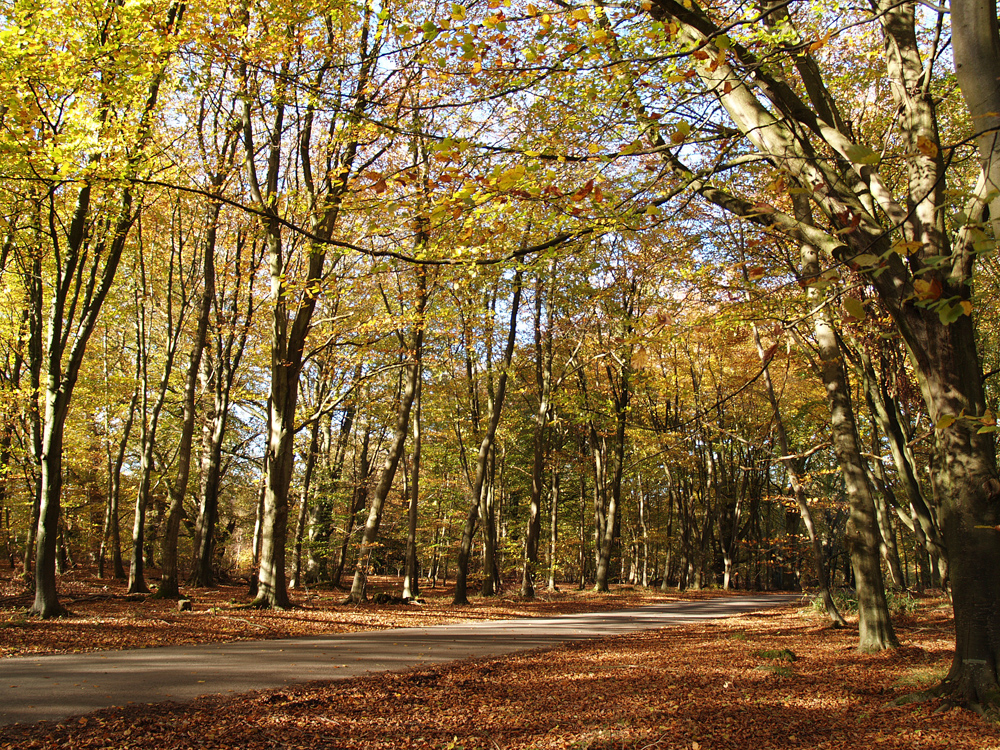
I continue the series of images from Savernake Forest, near Marlborough, which is privately owned by the Marquess of Ailesbury, that is so colourful each autumn. Since 1939 the timber of the forest has been managed by Forestry England on a 999-year lease.
October 2026 Review
The bulk of the first week was mild with maximum and minimum temperatures well above the October average.
The very wet night and following day on the 6th gave us the wettest day since the end of August that began to refresh the very dry gardens and refill empty water buts.
It was all change on the 7th as the wind swung from the southwest to northwest that brought a much colder air stream and a very cool day with the maximum of just 12.9C, being 2C below average. Quite a shock to the system after so many very warm and hot days, the first sign that autumn was approaching.
The following night saw the thermometer drop away to 4.1C, that made it the coolest night since 16th May.
There were a few particularly warm days in the second week when maxima were well above the October average with a high of 20.2C on the 15th. This was due to a flow of air from the southwest that contained tropical air brought up from the south as ex-hurricane Isaias was incorporated into a depression in the Atlantic. The exceptionally deep depression gave storm force winds around Iceland where it became centred.
It was all change on the 16th as a cold front passed over the country that behind it brought cooler air on a north-westerly breeze. The weather front deposited a useful 3.8mm of rainfall during the early hours of the 16th.
The reign of high-pressure systems that gave us fine, dry days over so many months came to an end on the 20th as the jet stream changed its path. It began to push depressions across the Atlantic rather than arching above the UK that had allowed anticyclones to push north from around the Azores area.
We waited many months for a reasonable fall of rain, during the extremely dry summer months, then in early autumn three deep depressions queued up to visit us one after the other. Storm Austen arrived on the 23rd and ran along the English Channel that produced a daily rainfall total of 26.3mm, which made it the wettest day since 26th January 2025. The winds picked up in the afternoon with a peak gust of 32mph.
Storm Austen deepened as it approached the UK, undergoing a process known as ‘explosive cyclogenesis’. Its central pressure fell by over 24mb in 24 hours, making it what is sometimes called a ‘weather bomb’. On the evening of the 22nd my records show the pressure beginning to drop at the rate of 1mb/hr at 19.30 as the centre of the storm entered the English Channel. By 21.00 the rate had increased significantly to 4.1mb/hr, then 5.2mb/hr at 22.00 and at its peak I logged a drop of 6.3mb/hr at 23.30 with a minimum of 987.9mb at 06.23 early on the 23rd.
Both Storm Austen and Storm Boelo deepened rapidly as they approached the UK. I have analysed the local barometric pressure for both storms and found that over Marlborough the pressure dropped 22.6mb for Storm Austen and exactly 24mb for Storm Boelo. The details were 1010.5b to 987.9mb for Storm Austen and 1013.3mb to 989.3mb for Storm Boelo.
As a matter of interest, the centre of Storm Boelo measured 964mb at midnight when centred over Scotland, whilst the standard atmospheric pressure at sea level is 1013.25mb. The highest pressure for the UK was 1053.6mb at Aberdeen on 31st January 1902 and the lowest with 925.6mb at Ochtertyre, Perthshire, on 26th January 1884.
As the month came to an end the Azores high began pushing back over the UK acting as a barrier to any new weather fronts attempting to reach the country. It also resulted in much calmer conditions after the strong winds of last week, it also meant that at night, as the temperatures dropped, fog formed in the early hours of the 29th and 30th.
The monthly rainfall amounted to 129.9mm, being 143% of my 43-year record using my 5” Met Office standard copper rain gauge, or plus 39.1mm. The contrasting years were in 2017 with just 31.3mm and the very wet year of 2020 when 191mm fell locally. There is a quite clear, upward trend for increasing rainfall over that period showing an average of around 75mm in the 1980s and during the 2020s around 90mm.
Not surprisingly, the mean temperature for October was above average at + 1.1C, that was an almost identical figure for both the average maximum and average minimum.
As gardeners we are aware that the first frost of autumn can damage tender plants if not covered or removed. I have analysed my data back to 1984 and found, no surprise, that there is a clear, general trend for that event to occur later in the season. In the 1980s, taking the datum as 1st September, on average it occurred 35 days later, now in the 2020s it is occurring, on average, 55 days later. Naturally there are considerable variations such as in 2024 when the first air frost occurred on 11th October and in 2025 on 18th November. As I complete this review there are currently no signs of a frost during the first week of November.