Friday 9th January
Thursday was dark and gloomy after first light due to the advance cloud from Storm Goretti. Light rain arrived at 12.40 then more steady rain after 15.20, continuing for most of the night. It was much lighter and sporadic after 19.00 and stopped for short periods around midnight and again just before 03.00.
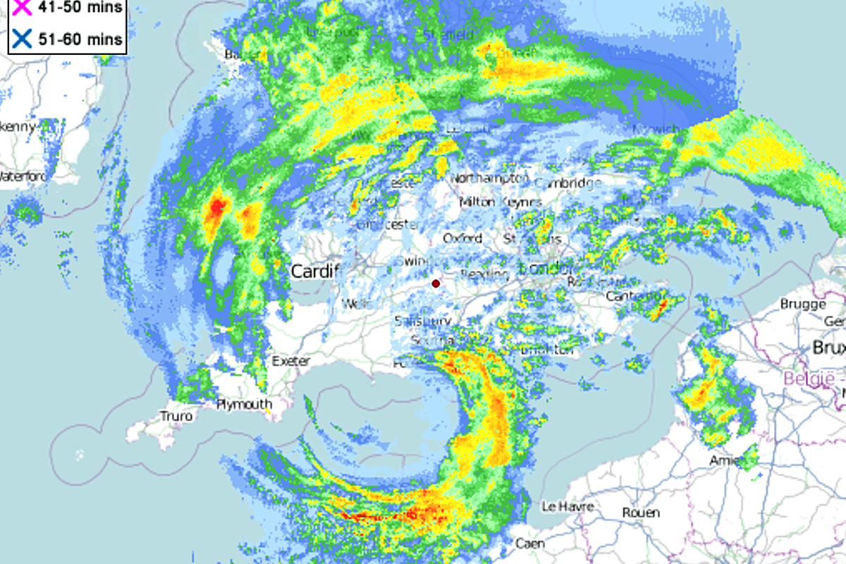
The centre of Storm Goretti passed over our area, which is why the winds were modest in the early evening and dropped out for a few minutes at 21.56, that coincided with the eye of the storm passing overhead with a barometric pressure of just 975.9mb. That barometric pressure was the lowest since 5th January 2025. The strongest winds are always towards the periphery of such systems when the pressure gradient increases as air rushes towards lower pressure. The maximum gust recorded was 28mph at 03.18. The tail of a depression is significant as it marks the location of the cold front, the boundary between warm and cold air masses, a source of active or severe weather, which brought strong winds along the south coast last night. The image I attach today was a screen shot of the depression at 21.40, minutes before the centre of the storm passed overhead. The rain and cloud pattern is a clear example of what looks like a Catherine wheel as the air rotates anticlockwise around the centre whilst it simultaneously edges eastwards. The red spot in the middle of the image is the position of Marlborough.
The temperature dropped away to almost freezing at 02.14 with a minimum of 0.6C, which is when it was likely the precipitation turned to sleet or wet snow from the back edge of cloud associated with the depression, as it eased eastwards. The equivalent rainfall over the past twenty-four hours was 23.0mm.
The thick, low cloud was still evident after first light on Friday, resulting from the back edge of the storm, which also accounts for the brisk winds, now coming from the northwest, a cool direction. The temperature will not rise much today due to the air flow originating around Iceland, dragged down on a brisk northwesterly all day, not subsiding a great deal until early evening.
Saturday will bring a much quieter, dry day as a transitory ridge of high pressure edges across the country, still cool although the wind from the northwest will become but light.
Milder weather will arrive from Monday as we come under the influence of traditional Atlantic weather systems.