Tuesday 13th January
The flow of warm, moist air continued on Monday, on a brisk southwesterly breeze that lifted the temperature to a maximum of 11.2C at 13.59. This warmth was aided by sporadic, welcome sunshine, the peak being 4.1C above average. The thick cloud cover overnight minimised any loss of warmth into the atmosphere with a minimum of 8.3C at 23.45. The temperature after that time fluctuated, up and down a little, to reach 9.3C at 08.00 Wednesday, rather than fall away as happens during most nights. This was entirely due to a thick area of solid cloud drifting in from the south, seen on the back track of the radar that reached our area at midnight.
Once again, the diurnal temperature range was minimal, just 2.9C between the maximum and minimum.
Tuesday struggled to come alive as the start to the new day was dark and gloomy under the thick cloud cover. The rain radar showed a large area of heavy rain, advancing from the south, to arrive around 08.30. This will be from a wide arc of heavy rain stretching from Devon to Kent and around 70 miles in depth.
As I finish this report, I note that the steady rain has arrived, just before 08.30.
There are two weather fronts crossing the UK today, the second later today will bring a dramatic change to our recent unsettled weather, just for a day. The second weather front will be a cold front, which will result in the temperature dropping during the afternoon as it heralds the colder air stream. This will be due to the depression edging away and a transitory ridge of high pressure edging between the old depression and the next arriving on Thursday. As the cold front moves away the sky will clear tonight, which will result in a much cooler night, in fact an air frost is possible. The temporary high pressure will bring a fine and sunny day on Wednesday, if much cooler,
Normal Atlantic weather will replace this temporary fine day with cloud and rain on Thursday, probably heavy and extended, as the next area of unsettled weather arrives from the Atlantic.
The Jet Stream forecast is for the unsettled weather to continue for the rest of the week and weekend, as it drives the areas of low pressure across the Atlantic. However by the start of next week there is the possibility of cooler air arriving as the jet stream fragments and dives to the south of the UK leaving us on the colder north side.
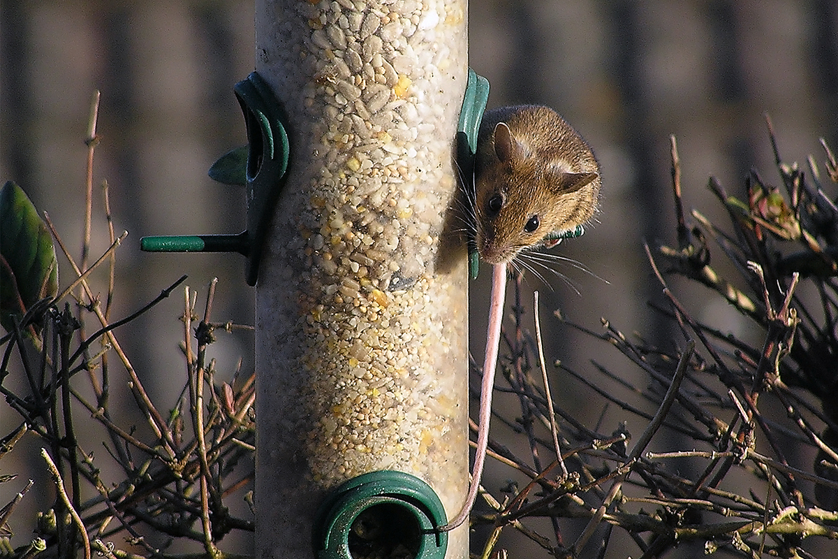
I managed to capture an unusual visitor to the bird feeder!