Windrush Weather

Category: Commentary

  • Low pressure firmly in charge for the next few days as multiple fronts cross our area

    Low pressure firmly in charge for the next few days as multiple fronts cross our area

    The very pleasant early autumn day on Tuesday brought us variable sunshine with reduced amounts during the afternoon as cloud built up. This was shown in the maximum of 19.7C being recorded in the early afternoon at 13.48 being 0.7C above average. A minimum 12.9C was logged at 07.13 early Wednesday, a mild night, which was 4.2C above average.

    The first rain overnight triggered the automatic rain gauge at 00.20 and again at 00.30 after midnight with a longer spell beginning at 03.30 that in total produced 2.2mm of rainfall. The bulk of the rainfall fell just to the east of our area, over Hungerford and towards London, starting just before dawn. This was due to two warm fronts crossing our area.

    Wednesday arrived with 8/8th cloud cover although there were weaker patches that after sunrise allowed brief lighter periods but no sunshine. Two further warm fronts will cross southern England later this morning that could produce a greater quantity of rainfall. The recent high pressure is now well to the east, over Russia, thus the depression has moved in to dominate our weather with the barometric pressure having fallen a significant 13mb since yesterday with a reading of 1003.1mb at 08.00, the lowest for a week.

    The depression will be lurking between Northern Ireland and Iceland for the next few days so showery weather will be the order of the day until the weekend with limited sunshine. There are indications that another depression will then arrive from the Atlantic.

    I was under time pressure yesterday to write the review and forgot to complete the data sheet and also the continuation of a report on the new weather satellites. The MetOp-SG-A1 satellite is designed to keep high-quality weather data flowing for decades while also improving how detailed and reliable that data is. The new satellites circle the Earth from pole to pole, scanning the entire planet in strips. That solar orbit gives them a global view, and includes remote areas where weather observations are hard to get.

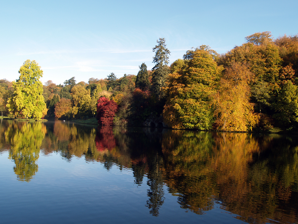
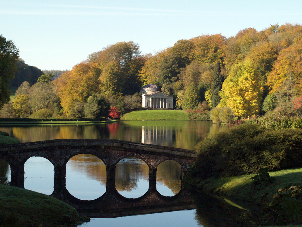
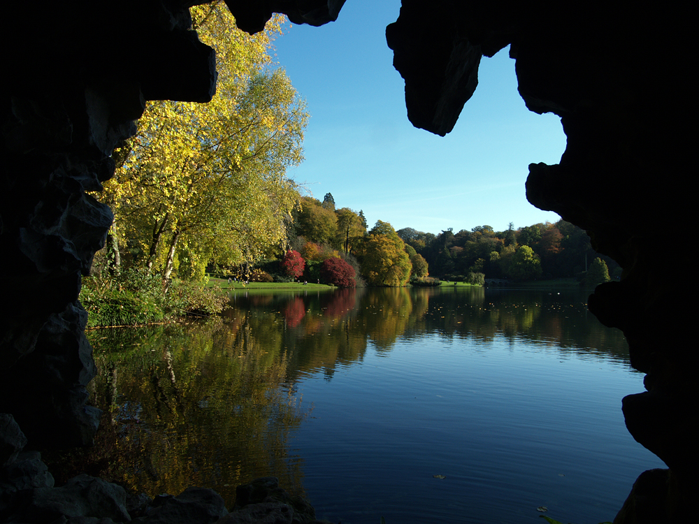
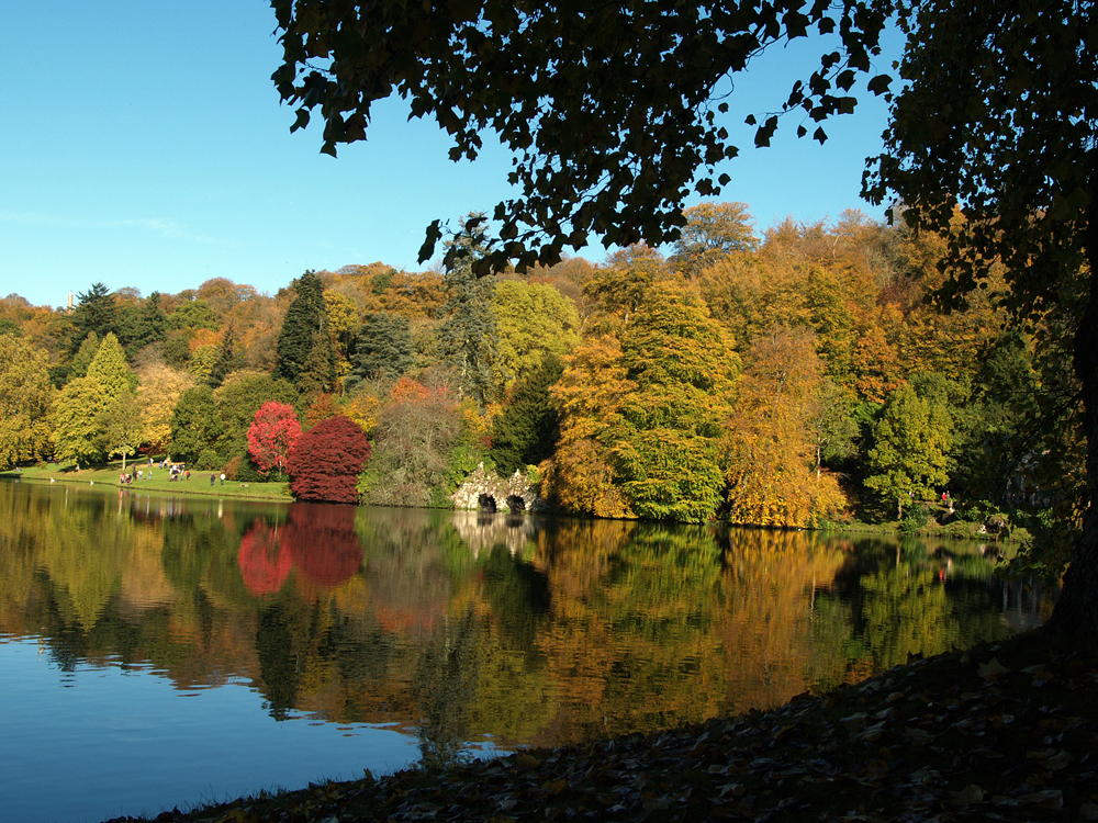
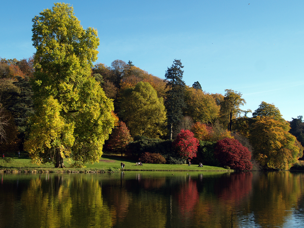
    Stourhead autumnal images: The lake is artificially created. Following a path around the lake is meant to evoke a journey similar to that of Aeneas’s descent into the underworld.

  • Battle between high and low pressure is slowly resolving

    Battle between high and low pressure is slowly resolving

    Tuesday 9th September
    Monday was a pleasant early autumn day with the sun gaining strength in the early afternoon resulting in a maximum of 20.5C at 14.35 being 1.5C above average. A clear sky and lack of wind overnight produced a very chilly night that saw the thermometer drop very low reaching a minimum of 5.7C at 03.43. This was 3.0C below average and the coldest night since 23rd May.

    We narrowly missed very heavy rain and thunderstorms on Monday that ran in a southeasterly direction a few miles to the west of our region, mid-afternoon. I got caught up in the first downpour.

    During the low temperature and calm conditions, the anemometer fell stationary at 19.15 Monday evening, meant radiation fog formed in the early hours of Tuesday. It was thin in the River Og valley at first but thick over the River Kennet valley that slow drifted in from the east after sunrise, which was hidden behind the fog. The fog had all but disappeared in the River Og valley by 07.30 and just before 08.00 had virtually cleared in the River Kennet Valley and over Savernake Forest.

    Today, Tuesday, the cloud from a warm front is just to the west of our area that will slowly move eastwards bringing cloudy conditions this afternoon and likely rain this evening. The rain had reached west Devon by 07.30 and was very slowly edging eastwards.

    The recent high pressure will slowly fall today as we come under the influence of low pressure in the Atlantic. In fact there are four areas of low pressure to the west of the UK that will edge closer over the next twenty-four hours that will by Wednesday bring bands of more heavy rain. This significant change in weather conditions will see the wind back into the south today before veering into the southwest later tomorrow and for the following few days.

  • High pressure winning today, but battle lines keep moving!

    High pressure winning today, but battle lines keep moving!

    Monday 8th September
    For most of the daylight hours on Sunday heavy rain and thunderstorms ran northwards to the west of our area, but very close to us, as they passed over Devizes and the edge of Calne. There was a brief shower at 10.45 that amounted to 1.0mm, which took the monthly total to 42.2mm set against my 41-year average of 66.9mm. The sun returned late morning that resulted in a maximum of 21.6C logged at 14.09, before cloud returned from a cold weather front, thanks also to a run of southerly air from the Continent, the peak temperature being 2.6C above average. The cold front passed over during the afternoon that unfortunately meant the thinning cloud from the back edge of the front obscured the ‘Corn’ moon and the ‘Blood’ moon. The clearing sky overnight allowed the thermometer to drop back but a minimum of 9.7C at 06.50, just after sunrise in Marlborough at 06.30, was 1.0C above average. The peak solar activity and UV level were the lowest this month due to the afternoon cloud cover.

    Monday began with hazy sunshine through thin high cloud. The high pressure is still exerting its influence over the UK, the pressure having risen 9mb since Sunday with a reading of 1015.9mb at 08.00. As a result it is keeping further weather fronts to the west as the depression eases towards Iceland. We should have another fine day on Tuesday but the forecast charts show a couple of depressions mid-Atlantic attempting to make a move towards the UK around midweek.

    I mentioned yesterday an article I had read about a new weather satellite that was launched recently from which I include more information. Though it has only been in space for three weeks, MetOp-SG-A1s instruments are already up and running. The Microwave Sounder pulls in data on temperature and humidity from different layers of the atmosphere that has superior resolution than previous instruments and more capabilities. Instead of the 48-mile resolution of older models, the new version can zoom in at about 12miles (19 kilometres). That kind of details helps spot smaller weather patterns and track them more precisely.

    I continue the sequence of autumnal images from the National Trust property of Stourhead, which is one of the most famous gardens in the English landscape garden style, near Stourton and Warminster in Wiltshire.

  • We are under threat from nearby depression today!

    We are under threat from nearby depression today!

    Sunday 7th September
    Saturday gave us the warmest day this month and the warmest night, all thanks to a drift of southeasterly air that originated from the near Continent. A maximum of 21.7C was logged at 15.30, being 2.7C above average whilst a minimum of 16.3C was a significant 7.3C above average logged at 06.53 early Sunday. The day was dry with the UV level reaching up to the’High’ category briefly, when the peak solar energy of 854W/ms was logged at 14.06.

    Sunday after dawn revealed a bright start but cloud could be seen slowly advancing from the west. There was brief, hazy sunshine through a band of thin cloud on the eastern horizon that was totally obscured by 07.30. After a very mild night the thermometer edged upwards to 16.9C by 08.00.

    The recent short lived high pressure has edged much further to the east that has allowed the UK to come under the influence of a depression just to the north of Ireland that is slowly receding towards Iceland. The barometric pressure has dropped 13mb since Saturday with a reading of 1007.5mb at 08.00. However, the western edge of the anticyclone is just sufficient to slow the eastwards progression of a cold weather front that was producing heavy rain moving northwards over east Devon and Dorset also the Bristol area at 08.00. We might just miss out on rain today, but it will be a close run thing.

    A rare total lunar eclipse “blood moon” will take place this weekend for the first time since 2022 where the Earth passes directly between the sun and the moon – making it turn red, and if the sky is clear it could be seen briefly from 19.30 Sunday evening.

    I recently came across the following report. Less than a month since launch, a powerful new weather satellite is already at work. As it silently orbits around the earth, it is sending back data that may actually make a difference in the way we know weather and can predict it. Launched on August 13, the satellite is named MetOp-SG-A1. It’s the first of a new generation of weather satellites developed in Europe. More tomorrow.

  • Another fine day ahead

    Another fine day ahead

    Saturday 6th September
    The variable sunshine on Friday, especially in the morning gave us the warmest day for a week with the thermometer rising to 21.3C at 16.00 being 2.4C above average. It was also the first dry day this month with the UV level rated at it speak at the top end of ‘Moderate”.

    Under clear skies the temperature dropped away to 9.6C by 03.43 early Saturday being 0.9C above average.

    Looking across the countryside after dawn on Saturday revealed radiation fog had formed in both the River Og valley and the River Kennet valley. The ground is still damp from recent rain thus the air is more humid, a reading of 96% was logged at 08.00. As the temperature drops overnight the moisture in the air condenses, especially near a water cause such as a river, forming fog. In fact, my station is perhaps 500m from the river and I noted at 06.30 that the temperature was 10.3C whilst the Dew Point was 9.6C, the latter being the temperature at which the air cannot hold any further moisture and forms fog or mist. By 07.30 the fog had dispersed in the River Og valley while that in the Kennet took another half hour to disappear. The other main factor, meteorologically, in the formation of fog is the lack of air movement. The wind dropped out last night at 20.34 with no sign of the anemometer moving until just after 08.00.

    The high pressure has moved across to the Continent, as forecast yesterday, as a result the air will arrive today on a southeasterly breeze bringing warm air from the near Continent.