Windrush Weather

Category: Commentary

  • Not a weather front in sight today!

    Not a weather front in sight today!

    Tuesday 5th August
    After a dull and murky start to Monday, thanks to Storm Floris, the cloud thickened late morning as the weather front crossed our area, that produced just a few spots of rain at 11.30 although more consistent but very light rain and drizzle were observed from 14.05 for nearly two hours. However, the quantity of precipitation was minimal with a total of just 1.2m. The weather front also meant subdued temperatures with the maximum reached at 12.40, rather than late afternoon as in summer, due to the thick cloud. The high of 21.9C was just 0.2C below the August average. As is usual the temperature fell away in the early hours of Tuesday with the minimum of 11.1C reached at 06.07, just half an hour after sunrise in Marlborough at 05.36.

    In direct contrast to Monday, Tuesday arrived with glorious sunshine that had lifted the temperature to 15.2C by 08.00. The day ahead will be dry with much sunshine as a ridge of high pressure has built in behind the weather front with the barometric pressure having risen 6mb since Monday as Storm Floris is now visiting Norway.

    Although breezy on Tuesday the removal of Storm Floris to Norway has seen not only the pressure rise but the isobars have begun to widen thus the pressure gradient has reduced, which will bring a less breezy day on Tuesday. Isobars are lines of equal pressure that can indicate wind speed and direction. They are like contour lines on a topographic map. Winds tend to blow parallel to isobars circulating counterclockwise around low-pressure ares in the Northern Hemisphere.

    Thankfully, the bug that recently meant it took ages for the website to publish each day, also updates to be ignored, has been cleared.

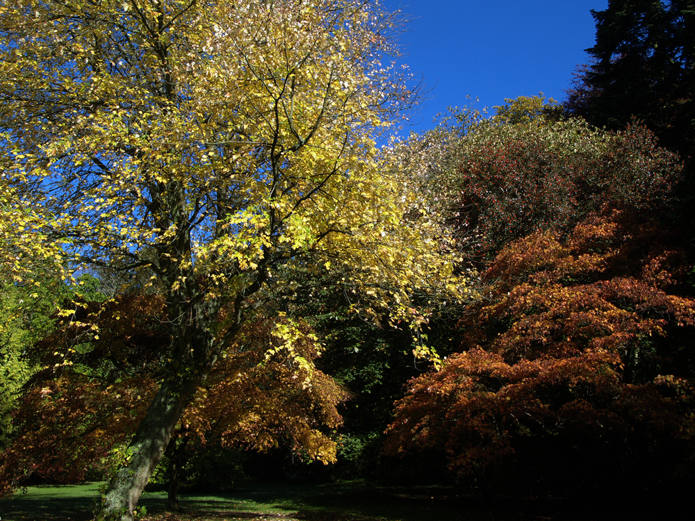
    This will be the last of the images from Compton Acres near Poole. Tomorrow I will start to a new series of images when we take a summer stroll through the Savill Gardens near Windsor Great Park.

  • Murky but mild day ahead with possible rain after midday

    Murky but mild day ahead with possible rain after midday

    Monday 4th August
    Although Sunday morning was cool, dull and overcast until early afternoon the sun did break through that eventually lifted the temperature to a peak of 24.4C at 16.14 being 2.3C above my long-term average. A minuscule shower passed over Marlborough at 14.05 that produced very light rain for a couple of minutes, blink and you would have have missed it, which was not measurable and didn’t even fully dampen hard surfaces, thus recorded as a ‘trace’. The minimum of 14.9C recorded at 05.52 early Monday meant that the past night was mild with the low 3.7C above average.

    First light on Monday revealed thin cloud on the eastern horizon that allowed a little brightness, however, this was very soon cut out by the advancing cloud, thus a mild and murky start to the new day under relatively calm conditions at the moment. The wind will pick up strength as the morning progresses. The breeze from the southwest started to pick up after 03.00 and will reach its peak early afternoon when any rainfall arrives.

    The recent anticyclone has receded over the past twenty-four hours as the deep low pressure system, that has been hustled across the Atlantic on a strong jet stream, arrived over Scotland. The centre of this very deep low pressure is forecast to be 978mb at 12.00, whilst at 08.00 our barometric pressure was 1016.7mb, down 3mb since its high yesterday and dropping around 1mb every three hours. As the centre of the depression reaches across Scotland the isobars will close up indicating a much windier day for us. The first rain shown on the radar at 08.00 was just approaching the Isles of Scilly. The fragmented weather front will produce the thick cloud cover for much of the day that could produce light rain arriving after around mid-day, with a very modest total.

    By Tuesday the deep depression will have left our shores and headed for Scandinavia with a ridge of high pressure reasserting itself that will bring a fine, dry and sunny day.

  • Weather fronts return today!

    Weather fronts return today!

    Without a weather front in sight on Saturday it was not surprising to find we had a dry and sunny day that lifted the temperature to 22.7C at 16.13 being back above average again, just, at +0.6C. The past night also was just above average with the thermometer reaching a low of 11.7C at 04.05 being +0.5C.

    Early risers on Sunday would have observed some brightness in the eastern sky after sunrise. There was thin cloud at first masking the sun from the advance cloud of a warm weather front currently crossing the UK that thickened by 07.30. A cold front will follow in its tracks that just might produced a very light shower early afternoon.

    The anticyclone is still maintaining a weak ridge over the UK keeping the worst weather at bay although with Storm Floris approaching the north of the UK, Monday is going to be variable, with limited sunshine and possible light rain in the afternoon, but no gale force winds over southern England although it will be very breezy with gusts of over 20mph.

    Storm Floris is the sixth named storm of the 2024/2025 Storm Naming season. Storm Eowyn – which occurred in late January – was the last named storm to affect the UK. Storm Floris is forecast to deepen significantly in the next twenty-four hours with a centre pressure of around 985mb on Monday over central Scotland bringing gale force winds and heavy rain, whilst over Southern England there will likely be variable sunshine and the possibility of light showers with a small drop in pressure to around 1015mb when at 08.00 on Sunday the reading was 1019.1mb and steady.

  • Not a weather front in sight today – but there will be tomorrow!

    Not a weather front in sight today – but there will be tomorrow!

    Saturday 2nd August
    The weather was not a full summer’s day on Friday although the afternoon sunshine did pick up the temperature to reach a peak of 20.6C at 15.39, however, this was 1.5C below my long-term August average. The UV level of 6.3 meant the strength was “High’ with 1037W/ms of peak solar activity. The clearer skies for most of the night meant warmth evaporated into the atmosphere until cloud began to drift down from the north around 05.30, as far as I can tell from the back track of the radar. The minimum of 8.8C meant a chilly night, being 2.4C below average, logged at 05.55, which was just after the sun’s supposed sunrise at 05.32, but it was not visible due to the cloud cover.

    The start to Saturday revealed that the cloud cover was total and quite thick, although the temperature had recovered to 12.2C by 08.00. It is interesting to note that in view of the imminent return of the Met Office to the BBC that the two forecasts today, published just after 06.00, did vary significantly. The Met Office indicated sunny intervals changing to overcast by lunchtime whilst the MeteoGroup forecast was sunny intervals all day. Time will tell! Please see paragraph below.

    The ridge of high pressure from the Azores High is still in place today that should mean a dry day with no weather fronts in sight, however, by Sunday the ridge will have returned westwards with a drop in barometric pressure that will allow at least one weather front to cross the country with the possibility of light shower activity.

    It was announced yesterday that the BBC is to reunite with the Met Office for its weather forecast and climate updates. The new partnership is aimed at delivering “the most trusted and accurate weather service to everyone in the UK”. A year or two after the BBC moved to the MeteoGroup I did a simple comparison of both services over a five day period on a couple op occasions and found that the Met Office, on average, had the most accurate forecast for the UK.

    July 2025 Review

    The latter end of the June heatwave continued on the 1st that gave us a very hot day peaking at 30.1C with three more warm and sunny days following until the 5th.

    The dominant Azores High had been begun to recede back into the Atlantic from whence it came on the 5th allowing a depression to the north, near Iceland, to take over our weather. There were a couple of very light and brief drizzle incidents during the morning of the 5th and 6th, with minimal rainfall, that soon evaporated.

    Referring to the cycles of hot weather followed by cooler and changeable weather the UK has seen recently, Met Office meteorologist Aidan McGiven said: “During the past three weeks or so the UK has been through two cycles of what appears to be a repeating weather pattern.” “Now we’re in July that heat has been pushed aside as the High pressure has retreated to the southwest, back to the Azores. This semi-permanent high pressure that you get near the Azores, known as the Azores High, has been ebbing and flowing from the southwest through the last week, hence this repeating cycle.”

    The Azores High is a semi-permanent area of high atmospheric pressure located over the eastern North Atlantic Ocean, typically near the Azores archipelago. It influences weather patterns across Europe as well as in North Africa, and parts of North America.

    The Azores High began to extend over the UK on the 8th, initially the breeze was from the northwest as the airstream travelled clockwise around the western flank of the anticyclone before streaming around its northern edge and then down across the UK.

    As the centre of the high relocated eastwards across the UK the breeze began to come from a southeasterly quadrant that allowed the heat to build combined with hot air pulled up from the Continent and produced our third heatwave of the year. The maximum reached in this heatwave was 32.9C on the 11th. The heat was intense that felt very uncomfortable when the maximum air movement, couldn’t be called a gust, was only in single figures and at times the anemometer was stationary.

    The high pressure began to lose its control on the 16th allowing a depression to the northwest to edge closer that saw the wind direction change to west and then southwest that brought a warm, and moist airflow.

    A disturbance, with numerous thunderstorms, developed over northern France on the 18th and drifted north over the UK overnight but, sadly for gardeners, once again the main rain band was just to the east of Marlborough, that gave us only 0.7mm. I again wonder if there is a geographical reason why in these shower situations the bands of rain, often drift predominantly to the east, and less extent, to the west of Southern England .

    The Azores High began to exert its influence again on the 23rd with a ridge over the UK. Initially, the air travelled around its western flank then came around its northern edge with the wind from the direction, that took the edge of the warmth. However, by the 24th the ridge had edged southwards over the UK allowing the air to flow from the west, that combined with the barometric pressure continuing to build, resulted in the temperatures beginning to climb again.

    The month ended with the Azores high edging westwards, just a little, that allowed several weather fronts to edge around its north periphery bringing showers on a north-westerly breeze. The 31st was the wettest day since 26th February with 9.3mm. This took the monthly total to 41.3mm being 69% of my 41-year average or minus 18.5mm. It was also the fifth successive month with below average rainfall. Analysing the year to date the rainfall for the period January to July gave us 338mm of precipitation when the 41-year average for those five months is 451mm.

    July was another month with above average temperatures as the mean was 1.9C above my long-term average. Breaking that down the average maximum was +2.4C and the average minimum was +1.9C.

  • Cooler and drier today after welcome rain yesterday – for gardeners!

    Cooler and drier today after welcome rain yesterday – for gardeners!

    Friday 1st August
    Thursday was notable for the frequent and heavy showers that passed over Marlborough on several occasions during daylight hours producing 9.3mm of welcome rainfall that has now filled all my five water buts. This was the wettest day since 26th February, also the wettest month since February, and took the monthly rainfall to 41.3mm set against my 41-year average of 59.8mm. It was significant that between the showers the sunshine was intense that produced the strongest peak solar energy of 1201W/m2 since the end of June. In addition, it was notable that the UV level rose to 7.3 at 11.52, not surprisingly, also at the time of the peak solar strength, being in the ‘Very High’ category, just before one of the heaviest showers arrived. As the sky cleared in the evening the temperature dropped away to reach a low of 11.0C at 05.25, just before the sunrise in Marlborough at 05.25.

    Friday arrived with variable sunshine that had lifted the temperature to 13.2C by 08.00. A cooler and drier day is ahead.

    The Azores High is showing signs of building back over the UK for the next couple of days that should result in drier conditions with longer spells of sunshine reappearing, especially on Saturday.

    NEWS FLASH
    Storm Floris has been named by the Met Office. This unseasonably disruptive system will bring strong winds and heavy rainfall across the northern half of the UK on Monday and early Tuesday.

    July 2025 Review

    The latter end of the June heatwave continued on the 1st that gave us a very hot day peaking at 30.1C with three more warm and sunny days following until the 5th.

    The dominant Azores High had been begun to recede back into the Atlantic from whence it came on the 5th allowing a depression to the north, near Iceland, to take over our weather. There were a couple of very light and brief drizzle incidents during the morning of the 5th and 6th, with minimal rainfall, that soon evaporated.

    Referring to the cycles of hot weather followed by cooler and changeable weather the UK has seen recently, Met Office meteorologist Aidan McGiven said: “During the past three weeks or so the UK has been through two cycles of what appears to be a repeating weather pattern.” “Now we’re in July that heat has been pushed aside as the High pressure has retreated to the southwest, back to the Azores. This semi-permanent high pressure that you get near the Azores, known as the Azores High, has been ebbing and flowing from the southwest through the last week, hence this repeating cycle.”

    The Azores High is a semi-permanent area of high atmospheric pressure located over the eastern North Atlantic Ocean, typically near the Azores archipelago. It influences weather patterns across Europe as well as in North Africa, and parts of North America.

    The Azores High began to extend over the UK on the 8th, initially the breeze was from the northwest as the airstream travelled clockwise around the western flank of the anticyclone before streaming around its northern edge and then down across the UK.

    As the centre of the high relocated eastwards across the UK the breeze began to come from a southeasterly quadrant that allowed the heat to build combined with hot air pulled up from the Continent and produced our third heatwave of the year. The maximum reached in this heatwave was 32.9C on the 11th. The heat was intense that felt very uncomfortable when the maximum air movement, couldn’t be called a gust, was only in single figures and at times the anemometer was stationary.

    The high pressure began to lose its control on the 16th allowing a depression to the northwest to edge closer that saw the wind direction change to west and then southwest that brought a warm, and moist airflow.

    A disturbance, with numerous thunderstorms, developed over northern France on the 18th and drifted north over the UK overnight but, sadly for gardeners, once again the main rain band was just to the east of Marlborough, that gave us only 0.7mm. I again wonder if there is a geographical reason why in these shower situations the bands of rain, often drift predominantly to the east, and less extent, to the west of Southern England .

    The Azores High began to exert its influence again on the 23rd with a ridge over the UK. Initially, the air travelled around its western flank then came around its northern edge with the wind from the direction, that took the edge of the warmth. However, by the 24th the ridge had edged southwards over the UK allowing the air to flow from the west, that combined with the barometric pressure continuing to build, resulted in the temperatures beginning to climb again.

    The month ended with the Azores high edging westwards, just a little, that allowed several weather fronts to edge around its north periphery bringing showers on a north-westerly breeze. The 31st was the wettest day since 26th February with 9.3mm. This took the monthly total to 41.3mm being 69% of my 41-year average or minus 18.5mm. It was also the fifth successive month with below average rainfall. Analysing the year to date the rainfall for the period January to July gave us 338mm of precipitation when the 41-year average for those five months is 451mm.

    July was another month with above average temperatures as the mean was 1.9C above my long-term average. Breaking that down the average maximum was +2.4C and the average minimum was +1.9C.