The many hours of strong sunshine on Wednesday lifted the temperature to 22.1C by 15.35 being 4.8C above average. The wind continued brisk and from the northeast peaking at 15mph. Much comment has been made about the continuing dry spell, which was compounded yesterday as the equivalent loss of rainfall from evaporation from ground sources and plant life reached 5.0mm, the highest loss since 20th June, inflated yesterday due to the little residual moisture from the minimal rainfall of 0.5mm that fell on the previous day. Once again the past night was chilly that saw the thermometer reach a low of 5.9C at 04.19, which was again below average of -2.1C, before cloud drifted across again from the North Sea.
Thursday revealed total cloud cover. Backtracking the cloud radar it was clear to see that thick cloud had drifted across from the cold North Sea, current sea temperature is 11C, arriving just after 04.00 that linked with the minimum temperature logged at at 04.19. The moist, cool air , not having been heated by early sunshine gave a humidity reading of 83.3% at 08.00. This cloud bank will, hopefully, thin and break up as the sun gathers strength during the morning. The thermometer had risen a little to 8.0C by 8.00, making it the coolest start to a new day for a week at that time, especially as wind chill was also factor making it feel only 7.0C outside.
The dominant high pressure will stay centred just to the north Scotland and push further south, there has been a further rise of 3mb since yesterday. The projection of the Jet Stream track indicates that this situation will continue into next week. The wind track shows it currently originating just east of Iceland, then travelling south down across western Scandinavia before crossing the North Sea, thus a very cool air stream.
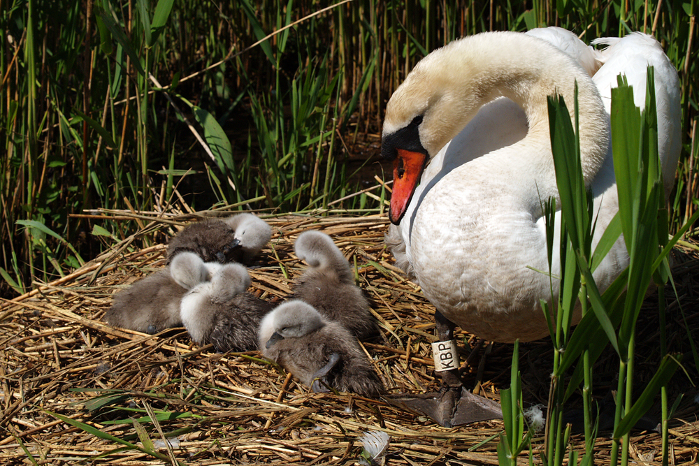
A selection of images from Abbotsbury Swannery will be added each day, which is the only place in the world where people are able to walk through the heart of a colony of 600 nesting Mute Swans. The site is on the south coast, just east of Weymouth.
Unfortunately, I hadn’t realised that when the website was rebuilt at the end of last year it had inadvertently restricted the width of the data sheets, making viewing less than ideal. This situation, hopefully, will be addressed soon, not something I can remedy, I just fill in the spaces!