The predominance of cloud on Tuesday limited the rise in temperature, reaching a maximum of 22.6C early in the afternoon at 14.11 being just below average for July. The UV level of 5.7 was the second lowest this month at the bottom end of ‘High’ due to the cloud cover that also gave us much reduced peak solar activity.
Wednesday arrived with total cloud cover with the wind having backed into a northerly quadrant, that later today will see it back a few more degrees to come from the north-northwest, so a cooler day ahead. Currently the rain radar shows a batch of heavy showers running south to the west of our region, over Dorset and Somerset, also to a lesser degree over London but nothing for us at the moment.
The Azores High has recently been showing signs of toppling over the UK that by Thursday will bring us a brighter, warmer day with the temperatures continuing to rise on Friday and Saturday as the anticyclone builds over the UK. The barometric pressure at 08.00 read 1014.6mb, which was the highest pressure for almost a week with the barometer indicating a steady rise. There is little sign of any rain over the next few days so little respite for the gardens under a hosepipe ban although there will not be the intense heat of earlier this month that baked the ground.
It was regrettable that the website went offline yesterday around 16.30. An upgrade was advised that had unintended consequences. Fortunately my website manager managed to get most sections up and running during the evening, being old I am not IT proficient, I just fill in the spaces.
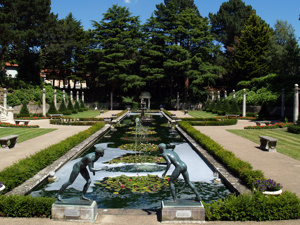
There will be a series of images from Compton Acres over the next few days. As it is summer it seems appropriate to take a walk around the grounds of one of the most important ornamental gardens in England.