Although there were occasional breaks in the cloud cover yesterday, with minimal sunshine (0.45 hrs),the main feature was the strong northerly winds that peaked at 21 mph. The maximum reached yesterday was 7.3C, which is 3C below the average, but the effect of the strong wind was to produce a wind chill factor that meant it felt like 4C for most of the daylight hours.
Overnight the thermometer dropped to -0.3C just before 4am. Dawn broke with clear skies and sunshine that is very slowly lifting the temperature.
Author: Eric Gilbert
-
Brrrr! Cold northerly brings wind chill
-
No sunshine, no UV and rain
Yesterday brought the first substantial rainfall for almost ten days with 4.4mm. Late in the afternoon the weather front began to clear eastwards and the cloud to thin. Subsequently, the temperature dropped steadily to a minimum of 0.8C just before 3am, in still conditions. Shortly afterwards the barometric pressure began to rise, from a minimum of 1004.6mb, the lowest for two weeks, and a slight breeze to pick up as the wind veered into the northwest.
This morning the thick cloud has allowed the thermometer to rise to 4.3C at 08.00, obscuring any possible sunshine. -
Temperatures recover after air frost
A bright, sunny morning yesterday meant the the temperature slowly recovered, after the sharp air frost, to a maximum of 10.2C, average for November. Another dry day. Overnight the cloud cover meant a minimum of 7.8C, well above average.
This morning dawned with much cloud and a light shower, amounting to 0.1mm. -
First air frost of season
After a lovely autumn day on Wednesday with 6 hours of strong sunshine followed by clear skies, initially overnight, it was not surprising that the thermometer dropped continuously. The minimum, at 02.21, was -1.6C and the first air frost since 1st May. November has continued where October left off with two dry days and the breeze from a north-easterly direction.
This morning there is thin cloud with weak sunshine as the thermometer slowly rises, reading -0.4C at 08.00. -
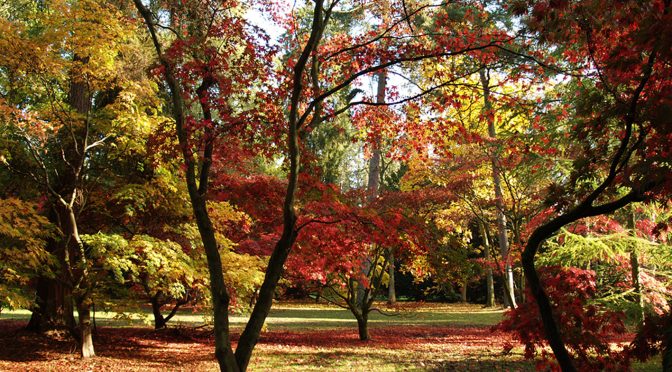
Summary for October 2016
This quotation from John Burroughs (1837-1921), an American naturalist, is so apt for the last couple of weeks. He is best known for his observations on birds, flowers and rural scenes. “October’s Party. How beautifully leaves grow old. How full of light and colour are their last days”.
Our weather is still breaking records. We have just enjoyed 23 dry days, average is 13, with a total of just 31.5mm of rainfall. This makes October 2016 a record month for my weather station with minimal rainfall of just 31.5mm, the driest since 1984.
Looking at my records I note how this month can be so different from another in that the previous driest was in 2003 with 36.8mm but the following October was a washout with 159.3mm. The 33-year average is 88.1mm. October was the second driest month in the year, after July, which is surprising being an autumn month.
The wettest day occurred on the 1st with 12.0mm with the second wettest on the 15th with 7.9mm. These two days make up two thirds of the rainfall recorded in October.
When the records for wind direction are studied the reason for this dry weather becomes clear. The winds for the month have been predominantly from the north to east quarter. There were several days with light drizzle brought in from the North Sea and four days with daily rainfall that was less than 1mm.
Although we did have many days with several hours of strong sunshine, the end of the month brought a number of days with thick, persistent cloud. The high pressure trapped beneath it stagnant air that was reluctant to move due to minimal wind. On the 25th and 31st the maximum gust all day was just 9mph and many hours when the wind dropped out altogether.
Analysis of the data for barometric pressure shows that the average daily pressure for October was the highest I have recorded for this month with 1023.3mb – another reason for the dry month.
The latter half of October is the time when, as a rule of thumb, evaporation of moisture from plants and ground sources into the atmosphere is overtaken by rainfall totals. At this point precipitation exceeds evaporation, which allows the rainfall to percolate down through the soil to the aquifers. October 2016 is an exception in that the evaporation for the month of 31.6mm is greater than the rainfall total of 31.5mm
The many dry days this month produced 95.4 hours of strong sunshine. This total exceeds those for the last two years, 2014 and 2015 gave us 65 and 68 hours respectively, since this instrument was installed.
Even though we had many dry days and much sunshine it was not a record month for temperatures. The beginning of the month was warm with maxima a few degrees above the mean but noteworthy was the 31st when the last of the very mild air pushed the thermometer to 17.6C. In fact the mean for October was 0.14C below the 33-year averages.
At least one air frost has occurred each October, sometimes as many as six, in the 1980’s and 1990s. However no air frost occurred in the year 2000, with several years since frost-free, but the last four consecutive years have also been frost-free.
There were four days in the month when fog formed overnight with visibility down to 200 metres although when the 31st dawned this dropped to 100 metres before the sun broke through.