Windrush Weather

Author: Eric Gilbert

  • Depression still lurking too close for comfort today

    Depression still lurking too close for comfort today

    The predominantly cloudy skies on Saturday, with occasional bright intervals, meant the maximum of 14.8C, logged at 13.40, made it the coolest day since the 18th, however, it was still significantly above average with +4.1C. Likewise, the past night was much cooler that saw the thermometer drop to 6.1C, logged at 06.17 before the sun got to work, which was also well above my long-term average with +3.4C.

    Although much of southern England was under a large area of cloud on Sunday morning, there was a small hole of thin cloud over central southern England that gave us a very welcome sunny start to the new day. This boost of sunshine lifted the thermometer to 9.0C by 08.00. However, the radar shows a large bank of cloud quite close to southeastern Britain, with heavy showers and possible lightning, that might drift closer later this afternoon. There is a noticeable shift in wind direction today with the breeze having backed from the southeast over the past four days to come from the north, but thankfully light in strength.

    France is not keeping the recent depression to itself, currently lurking over Brittany and still throwing banks of cloud over the UK and will likely dominate for much of Sunday. However, the outlook is for this low pressure system to slowly fill as a ridge of high pressure asserts itself on Tuesday. The barometric pressure has already started to slowly rise, up 3mb since yesterday.

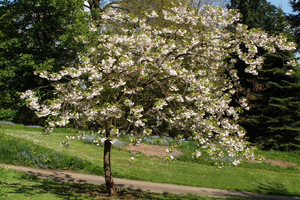
    The general view is that the soil temperature needs to be at a minimum of 7C or 8C before seeds in the soil can germinate. I think gardeners will begin to have thoughts of planting for the new season this coming week as the soil temperature at a depth of 6cm read at 08.00, was logged at 9.2C, 8.9C and 8.8C for the past three days respectively. The forecast for the coming few days is for it to be a little cooler but still above average by day also, at the moment, no overnight frosts are thought likely. I noticed this morning that a few sweet pea seeds that I planted optimistically some three weeks ago, in a sheltered small area, have started to throw the first shoots above ground.

    Update at 08.45. The radar shows the cloud encroaching over our area from the north and southeast, an unusual scissors movement, with the sun now being blocked out.

    I will include the daffodil image again as they are currently at their best but any heavy rain and strong winds will spoil them. Some of mine were close to the ground after the rain on Friday evening.

  • Modest rainfall, first for nine days

    Modest rainfall, first for nine days

    Friday brought variable cloud resulting in variable sunshine that combined with a brisk southeasterly wind dropped the maximum a couple of degrees from the Thursday peak with a maximum of 17.3C at 15.00. However, this peak was 6.6C above average and occurred when the cloud radar showed a large patch of more or less clear skies over southern England between 14.00 and 16.00.

    The first rain drops for nine days was noted just before 19.00 with a heavier pulse at 19.35, which totalled 2.9mm, that took the monthly rainfall total to 4.4mm when the 40-year average is 62.9mm.

    The cloud overnight meant a mild night with the thermometer not dropping below 8.5C at 03.38 early Saturday.

    Saturday revealed a cloudy start to the new day with the thermometer having recovered to 9.3C by 08.00. The two major UK weather forecasters cannot agree whether there will be light rain this afternoon! The humidity at 08.00 was logged at 93.5%, the highest for over a week and was due to the rainfall last evening. Currently, the radar shows a thick area of cloud crossing the Channel from France and heading northwest over southern England as a result there is not much possibility of sunshine today, perhaps a little weak sunshine this afternoon if the cloud thins.

    The centre of the depression is just off the western approaches and is forecast to linger over France for the next day or so. This slight relocation will see the wind back from southeast today to north on Sunday. This will be a cooler direction so the peak tomorrow will be depressed from the very warm days of this past week.

  • Spring in the step yesterday, but all change today

    Spring in the step yesterday, but all change today

    The first day of Spring on Thursday gave us the warmest day all month also since 19th September (22.3C), which was a significant 9.1C above my long-term average. We have just enjoyed the warmest night this month when the thermometer did not sink below 8.8C, logged at 06.29 early Friday, being 6.1C above the long-term average. It follows that it has been the warmest start a day at 08.00 this month with the thermometer having edged back upwards to 9.5C.

    The other feature to record yesterday the highest all month was the loss of equivalent rainfall through evaporation from the ground and plant life that gave a daily total of 2.5mm. The loss for the month is now a significant 30.7mm set against the minimal rainfall of 1.5mm.

    There is a significant change in our weather for Friday. The recent high pressure, that dominated our weather for well over a week, has given in and allowed the depression, that has lingered around Iberia for four days, to take charge of our weather today. The barometric pressure dropped 12mb over the last twenty-four hours, reading 1008.1mb at 08.00, the lowest since the 13th. The cloud built up yesterday and overnight and today will minimise any sunshine, if any, that is likely to be weak. A weather front and its associated rain band will make progress over the UK later this afternoon and evening, the rain radar indicates that this could be the wettest day for almost a month with a significant fall. Rain is currently over Cornwall and the radar shows minor outbreaks coming in from the south coast, currently heading toward Basingstoke, on a brisk southeasterly. As the depression edges closer, the pressure gradient will increase with a consequent strengthening of the wind as the day progresses.

  • Spring Equinox today

    Spring Equinox today

    The maximum of 16.6C at 15.11 on Wednesday made it the warmest day since 25th November (17.1C) and a significant 5.9C above my long-term average. It felt very warm in the glorious sunshine, especially as the breeze from the southeast, a much less cold direction that recent northeasterlies, was much lighter, only just into double figures, with a peak gust of just 11mph on one occasion.

    Under the sunshine and light breeze another 2.1mm of equivalent rainfall was lost through evaporation from ground sources and plant life, now totalling 28.2mm, against the minimal rainfall for March of 1.4mm, when the 40-year average is 62.9mm.

    So far in March we have only had two days when there was precipitation. The coming weekend will see more unstable weather arriving as the high-pressure relinquishes control and the depression, now over Iberia, approaches the country, with cloud and lower temperatures also the possibility of light rain.

    The UV level rose again, at its peak, up to the ‘Moderate’ category.

    The past night was much less cold than recent nights with the thermometer not sinking below 6.1C logged at 05.56, making it the warmest night since the 5th (6.4C) due to the warmer air mass and broken cloud overnight limiting loss of warmth into the atmosphere.

    Spring Equinox. Some research reveals that the word ‘equinox’ comes from the Latin language and means equal night.

    It would be easy to assume that day and night would be of equal length of 12 hours each. However, that is not entirely true.

    At the equinox, the measurement is taken from when the centre of the Sun is at the horizon and there are 12 hours between sunrise and sunset.

    The top edge of the sun is visible first at sunrise and last at sunset. Due to refraction, there is still light for a short time even when the sun is no longer visible. This adds a little extra time to daylight hours.

    The concept of the spring equinox was celebrated by ancient civilisations such as the Egyptians, Greeks and Persians, often associated with rebirth of nature and fertility rituals.

  • Wall to wall sunshine on Tuesday and the maximum above average

    Wall to wall sunshine on Tuesday and the maximum above average

    The high on Tuesday of 12.3C, logged at 15.17, was the first above average maximum since the 10th being +1.6C. This increase in warmth was very welcome and due to the wall-to-wall sunshine, although in the brisk easterly breeze it still felt chilly. The past night, under clear skies and little breeze to stir up the air mass, gave us 5 hours of freezing conditions from 01.57 to 06.53 early Wednesday producing another air frost, but not severe, with a minimum of -0.8C at 05.59.

    By 08.00 on Wednesday the sun had got to work over the previous hour so that by 08.00 the thermometer had risen to 3.9C between broken cloud. Today will give us a sunny morning but more cloud is forecast to drift up from the south to give us weaker sunshine in the afternoon.

    A significant change in the wind direction to southeast today will continue the increase in warmth, so outside it will feel very much warmer than previous days.

    The high pressure is still fending off the advances of the deep depression just off the coast of Iberia. The barometric pressure has fallen another 3mb since yesterday, but down 5mb since the high on Sunday.

    The equivalent loss of rainfall through evaporation from ground sources and plant life rose to 2.4mm over the past twenty-four hours. This was the greatest loss since 18th September under the continuous sunshine, brisk wind and increased warmth. There is a possibility of some rain on Saturday but the forecast of quantities is not confident at this time.