Windrush Weather

Author: Eric Gilbert

  • River Og has dried up according to Thames Water website. See below

    River Og has dried up according to Thames Water website. See below

    Sunday 9th August
    The heat continued to build on Saturday, eventually peaking at 27.2C, which was just above the heatwave threshold. The maximum was logged early in the afternoon at 14.14 as just before 14.00 cloud began to drift across then thicken as the afternoon progressed thus limiting any further rise in temperature. The past night was not quite so chilly as the previous two nights, dropping to a minimum of 8.6C at 06.08, which was 3.2C below average. The sun’s strength was very limited after sunrise, due to considerable cloud cover, hence the much later time when the thermometer reached the minimum.

    Due to the cloud cover the thermometer had only reached a temperature of 14.0C by 08.00 on Sunday, making it the second coolest start to a new day at that time, Friday read 13.7C. The back track of the cloud radar showed bands of cloud arriving from the east just before 06.00. The cloud will be variable with sunny periods this morning, that are likely to intensify and lengthen after around 13.00, which will likely push the temperature very high again late afternoon.

    The depression between Iceland and Norway will attempt to push a cold front down across the country overnight, sadly no rainfall within it, that will slowly peter out and leave us with perhaps a cloudy start to Monday. The air behind the weather front, as the name indicates, will mean a less hot day on Monday. By Tuesday the high-pressure will be a little further to the east that will once again push hot Continental air across the country, which will mean temperatures will be well above the heatwave threshold, likely 30+C.

    I regularly monitor the Thames Water website for date on the Groundwater situation and on local rivers. All the local Groundwater boreholes say the State of all eight are ‘Normal’ with the close by Draycot borehole, near Chiseldon, stating the Trend is ‘Falling’, all the other seven show the trend is ‘Steady’. However, I was concerned yesterday when looking at the river data that the depth gauge for the River Og at Poulton Farm registered ‘Height’ 0m, ‘Trend’ ‘Steady’ and ‘State’ ‘Low’ and that it had registered the height of 0m at 03.30 on August 4th. I wandered down to the river by Poulton Bridge fearing the site of a dry river bed, but thankfully found that in fact it had not dried up, however the average depth must have been around 2/3cm and it was flowing so very slowly.

  • The start of yet another heatwave after chilly night

    The start of yet another heatwave after chilly night

    Saturday 8th August
    The heat began to build again on Friday, under a predominantly clear sky after a cold start, that resulted in a maximum of 25.2C at 16.31 in strong afternoon sunshine. This peak was 3.6C above my long-term August average. The past night was the second consecutive very cool night due to the clear sky and calm conditions, from unusually late evening after 22.00, and the residual cooler airstream from the northwest. The minimum of 5.8C was exactly 6C below average.

    Saturday arrived with sunshine after sunrise that was initially a little muted from fair weather cloud on the eastern horizon, however, by 08.00 the thermometer read 15.9C and was rising steadily.

    The soil temperature at a depth of 5cm, read daily at 08.00, has reflected the fall away in retained heat overnight due to lower temperatures by day and night, however, the reverse has seen the heat begin to be absorbed again. The temperatures over the last five consecutive mornings have been 22.9C, 20.7C, 18.7C, 17.1C then today, the beginning of a rise with 19.4C.

    The depression to the south of Iceland is still lurking close by that will attempt to throw weather fronts southward across the UK but the high pressure will halt their southwards progression well before they reach northern England. Sadly for gardeners, there seems to be no possible rainfall in the foreseeable future.

    The fifth official heatwave of 2026 is about to arrive, that could last a week.

    The centre of the recent anticyclone will ease away towards Russia over the weekend, however, all the while the Azores high is beginning to make an attempt at pushing a ridge northeastward across the UK and linking up. The forecast pressure charts indicate that for most of next week we will continue under high pressure that by mid-week could see maximum temperatures rise into the low 30s.

  • Yet another anticyclone decides to visit the UK!

    Yet another anticyclone decides to visit the UK!

    Friday 7th August
    The past twenty-four hours have produced the coolest day and night for over two months. In fact, the maximum of 21.8C, logged at 17.58 on Thursday, was only 0.2C above the average that made it the lowest peak since 14th June. The minimum of 5.7C at 05.54 meant a chilly night being a significant 6.1C below average that made it the coolest night since 16th May. The reason for the low temperature was a clear night, the total lack of any breeze after 00.10 and the cooler air brought on the northwesterly breeze during daylight hours.

    Friday began as Thursday, with clear sunshine after sunrise that slowly lifted the temperature to 13.7C by 08.00, the coolest start to a new day at that time since 15th June.

    The latest high pressure system is now centred over the UK on its travels eastwards towards Scandinavia. Today will see the air movement light and principally from the west-northwest, still a cooler direction but with a little less cloud in the afternoon than on Thursday, as a result the maximum will begin rise higher than yesterday.

    The heat will begin to build from Saturday onwards due to the high pressure being further east that as the day progresses will see the air movement change to a southerly direction that will once again begin to feed in heat from the Continent. As the anticyclone edges further east towards eastern Europe, from Sunday onwards, it will grow in size and link up with a mate developing to the west, a new high pressure system arriving from the Azores. This will result in an unusually very large area of high pressure extending from mid-Atlantic towards Russia.

    Recently I was stopped in the street to ask how such a small amount of rainfall, the 0.2mm recorded last month, could be measured. For use with the 5″ copper Met Office rain gauge, records here go back to 1984, the captured precipitation is poured into a hand-crafted vertical glass calibrated in mm, the smallest amount is 0.1mm. It is an expensive item that I recently broke that cost £75 to replace!

    The automatic rain gauge uses a tipping mechanism. Once an exact weight for 0.2mm of liquid, the smallest increment that it is designed to measure, has arrived in the very small bucket it then immediately empties, sends an electronic pulse to the memory and the opposite bucket swings into place.

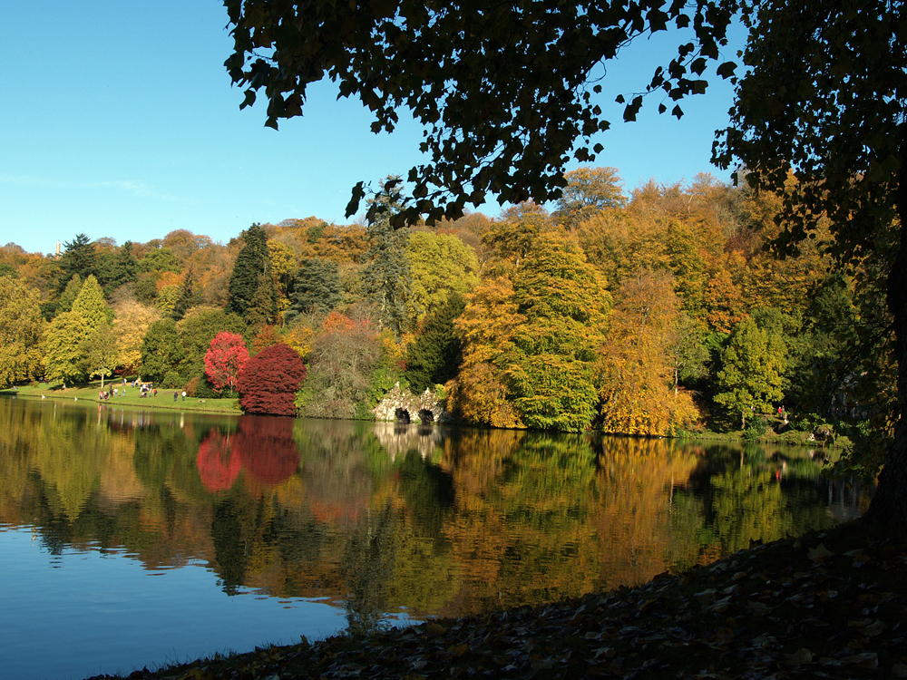
    The new series of pictures will be of butterflies captured over recent years. Sadly there seem to be very few, if any butterflies locally the year, even a buddleia had only one over the past few days when being observed on numerous occasions.

  • Oh no! Another heatwave possibly around the corner

    Oh no! Another heatwave possibly around the corner

    Thursday 6th August
    Wednesday was such a pleasant day with variable cloud and warm sunshine, not the excessive heat of recent days. The thermometer peaked at 23.2C being just 1.6C above average that made it the coolest day since 19th August. The past night saw the temperature drop below the August average with a minimum of 9.5C at 05.13, which was just a few minutes before sunrise at 05.38.

    The new day on Thursday began with modest sunshine that had lifted the temperature to 15.8C by 08.00. Today is going to be the last of the much cooler days with a maximum close to the average before the heat returns over the next few days. A large area of cloud, associated with the low-pressure system towards Iceland, is just to the north of our area that will push down across southern England today which will give us a day dominated by sunny periods between breaks in the cloud cover.

    The Azores high has not give up and over the past twenty-four hours has pushed back across the UK and towards Europe with the pressure having risen another significant 10mb since yesterday.

    The anticyclone will extend and relocate towards the weekend sending hot weather back over the country that is likely to reach heatwave temperatures well into next week. The approaching low pressure system will be overcome and slide south over Spain by the weekend. The depression near Iceland will attempt to push weather fronts across the country but be rebuffed by the anticyclone.

    Even though the extended dry spell continues there is still a daily loss of equivalent rainfall due to evaporation from the ground and plant life of over 4mm daily, already 22mm this month.

    Why has it been so dry recently?

    Author: Met Office
    Tue, 04 Aug 2026

    The role of heat
    The dryness has also been intensified by heat. July was characterised by back-to-back heatwaves and exceptionally warm temperatures, which worsened the dry conditions by drying out soils and increasing pressure on water resources.
    When temperatures are high, evaporation increases and soils lose moisture more quickly.

    This means that dry conditions can become more severe even without a complete absence of rain. Warm, sunny and breezy weather can all accelerate the loss of moisture from the ground, vegetation and water bodies.

    The result is that rainfall deficits become more noticeable. Gardens, farmland, river catchments and reservoirs can all come under increasing stress, especially when warm conditions follow an already dry spell. That is why recent heat has played such an important role in how dry the summer has felt and in the development of drought conditions across Wales and parts of England.

  • Rain! A much fresher airstream follows weather front.

    Rain! A much fresher airstream follows weather front.

    Wednesday 5th August
    With a maximum of 27.2C on Tuesday, logged at 13.33, it was an official heatwave after three days when the peak was equal to or above the threshold. The high was 5.6C above average. The sunshine was intense again that saw the UV light rise to the top of the High category, the highest since 12th July.

    The significant feature of the past twenty-four hours was the arrival of a short shower from 02.37 to 02.40, early Wednesday, that produced 1.2mm of precipitation. It was the first measurable rainfall in 34 days. By 07.00 almost all evidence of the rain had evaporated from the dry and warm hard surfaces. It was a bonus as it will have cleared dust from the atmosphere and washed dust of plants.

    The overnight minimum of 15.9C was 4.1C above average occurring at 05.17, just before the official sunrise in Marlborough at 05.36. However, there was much cloud cover that limited the evidence of sunshine, bar the occasional burst between minimal breaks in the cloud cover, which was the result of a weather front crossing the area. This was the reason the thermometer only rose a little; from the minimum to reach 17.4C by 08.00. It will give us a much cooler day today, also over the next few days, with maxima close to the August average due to the breeze coming from the West also brisk, arriving from the Atlantic.

    As the recent depression moves further away towards Scandinavia, the Azores high has started to take advantage and has begun to push back across the UK with the result that fine weather with higher temperatures will arrive from Friday onwards with maxima several degrees above the August average by Saturday, possibly not far off heatwave threshold temperatures again. The evidence – the barometric pressure has begun to rise slowly, having gained 4mb since yesterday.

    Why has it been so dry recently?

    Author: Met Office
    Tue, 04 Aug 2026

    After an exceptionally dry July for many, questions are understandably being asked about why rainfall has been so limited and whether there is any meaningful rain on the way.

    Persistent patterns have kept rain away

    The main reason for the recent dry weather has been the persistence of weather patterns that have kept the wettest conditions away from the areas that need rain most.

    Through much of July, the dominant pattern largely restricted rainfall to northern parts of the UK, while southern regions saw very little rain, often receiving only a small fraction of their typical monthly average. This meant that even when the UK as a whole saw some unsettled weather at times, rainfall was not evenly spread.

    In summer, this can be particularly important. Showers and rain bands may bring locally heavy rainfall in some areas, but leave others almost completely dry. If the same broad pattern repeats over several weeks, rainfall deficits can build quickly. Southern and eastern areas are especially vulnerable in this type of setup, because they can often sit on the drier side of weather systems while the north and west see more frequent rain.