Windrush Weather

Author: Eric Gilbert

  • Two more intense heat days before a slight easing begins on Sunday after 31.2C yesterday.

    Two more intense heat days before a slight easing begins on Sunday after 31.2C yesterday.

    The heatwave threshold for Wiltshire is 27C, which was reached on Thursday at 11.54, before the relentless sunshine continued to raise the temperature reaching a maximum of 31.2C late in the afternoon at 17.17, being a significant 8.5C above my long-term average. It was the hottest day since 14th August 2022 when 33.2C was recorded. The heat was very slow to ebb away into the very warm atmosphere overnight with the minimum of 13.4C logged at 05.03 at the time the sun rose over Marlborough. The humidity level, as expected thanks to the long, dry, hot period, was very low registering a minimum of 35.3% at 18.22.

    The start to Friday was a repeat of Thursday with strong sunshine after sunrise that saw the thermometer reach 22.0C by 08.00 under a cloudless sky.

    Not surprisingly, the rate of evaporation into the atmosphere from ground sources and plant life is considerable each day. On Thursday we lost the equivalent rainfall of 5.7mm with the total loss for July todate of 43.5mm when we have received just 6.2mm of actual rainfall.

    The centre of the high pressure has relocated a little further east. As a result the very light breeze will vary in direction between south-southwest and southeast on Friday, a warmer direction than the recent northwesterly, that will mean the peak temperature is likely to exceed that of Thursday.

    By Sunday there are signs that the anticyclone will have relocated further east and dropped in pressure over the UK allowing a low pressure system to the northwest to edge a little closer, reducing maxima with possibly some cloud cover.

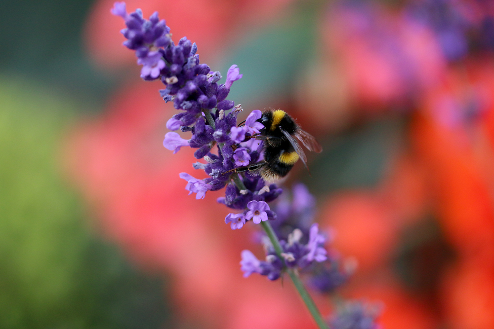
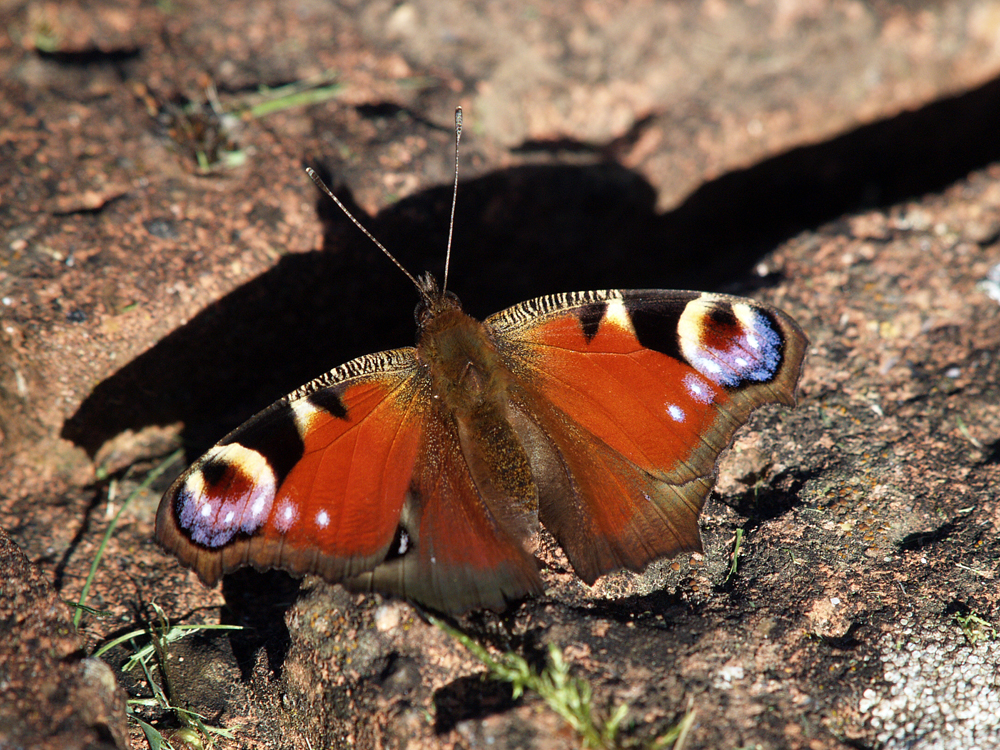
    Over the next few days I will include a variety of butterfly images that have been abundant this week. Today is a Peacock butterfly.

    Update:
    27C reached at 10.05
    28C reached at 10.29
    29C reached at 11.01
    30C reached at 12.08
    31C reached at 13.28
    32C reached at 14.28
    32.9C maximum reached at 16.18

  • Hotter and Hotter! Buck moon tonight

    Hotter and Hotter! Buck moon tonight

    The heat continued to build on Wednesday, peaking at 27.8C late in the afternoon at 17.08, being a significant 5.1C above my long-term average. This is the first day that the temperature has equalled or exceeded the Heatwave threshold temperature, which is likely to be confirmed on Saturday after three consecutive days exceeding the threshold, although the next five days will also be above 27C. The past night has been very mild with the thermometer falling to 13.7C at 05.23, just after sunrise in Marlborough at 05.02, being 1.8C above average.

    The sun shone strongly just after sunrise that had lifted the temperature to 21.8C by 08.00 making it the warmest start to a day at that time since 25th June 2023. The anticyclone continues to build with a pressure reading of 1024.2mb at 08.00.

    The centre of the high pressure is easing eastwards, currently over the southern Celtic Sea, that will see the breeze continue from the northwest today and be very light. However, as it continues that migration, in the early hours of Friday the direction of the breeze will change significantly to come from the southeast on Friday allowing the heat to continue to build.

    There is a Buck Moon tonight at 21.37, when the moon will sit unusually low in the sky. Historically, July’s full moon is called the Buck Moon because it aligns with the time of year when the antlers of male deer, or bucks, are quickly growing, named by Indigenous North American Algonquin people.

  • Warmth continues to build after a very chilly night

    Warmth continues to build after a very chilly night

    Tuesday was the third consecutive day when maxima were steadily rising with a peak of 24.8C late in the afternoon at 17.42 being 2.1C above my long-term average. There was a rather surprising low temperature overnight with a minimum of 8.5C at 05.02 early Wednesday, just as the sun rose over Marlborough at 05.01, which was 3.4C below average.

    Wednesday began with glorious sunshine that was quite comfortable first thing until the sun got to work just after 07.30 which lifted the thermometer to 17.5C by 08.00. However, minimal, high cloud was noted drifting down on the light northwesterly breeze that coil limit sunshine this afternoon.

    We might just reach heatwave conditions today as the maximum temperature indicated by both major weather forecasters is for a maximum of 27C. The high pressure continues to build that has seen an increase of 11mb since Monday with a reading of 1022.5mb at 08.00.

    We are still under the Azores High that is not quite centred over the UK hence the airstream running clockwise around its western flank, then turning east and south over the UK, will continue the northwesterly breeze for today and one more day on Thursday. By Friday the centre of the anticyclone is forecast to build as it shifts further east over the UK that will see the wind change to come from a southeasterly quadrant for the following few days when the heat will really build.

  • Warmth begins to build after below average maximum and minimum yesterday

    Warmth begins to build after below average maximum and minimum yesterday

    Monday was a pleasant sunny day without the extreme heat of recent weeks under the heatwave conditions, after the morning cloud moved on. The thermometer steadily rose to a peak of 22.2C at 16.31 being 0.5C below average whilst the past night was cool, and also below average at -1.2C, with a minimum of 10.6C logged at 05.10 early Tuesday just after sunrise in Marlborough at 05.00. The early morning light precipitation soon evaporated as the sun got to work and the gusty northerly wind picked up speed, peaking at 19mph.

    Tuesday brought a bright and sunny day with the wind still strong, however, from a more north-northwest direction.

    The Azores High is currently elongated in shape ridging across the country with the airstream circulating clockwise around the anticyclone, as they do. This is bringing the warmth from the Azores region around the northerly edge of the high before turning south across the UK, which will mean a more northwesterly breeze today.

    There is a possibility that the heat will increase significantly on Wednesday and then be the start of another heatwave, that could last in excess of a week. It is chastening to realise that the extreme heat can produce excess deaths. During the intense heatwave of 2022 there were in excess of 4,000 additional deaths. Research shows that with maxima in excess of 25C there is an increase of 30% of deaths in England and 60% increase in Wales. The outlook is for the maxima to be well above that temperature for a week or more.

  • Damp start but little total precipitation.

    Damp start but little total precipitation.

    The cool northwesterly breeze and variable sunshine on Sunday afternoon limited the rise in temperature to a maximum of 21.4C at 12.29 being 1.3C below average. The afternoon was marked by a rash of showers developing to the north of our area with the occasional one producing brief light rain and drizzle over our area at 13.00 and later at 13.35. The past night was again mild with a low of 12.2C at 06.57 due to the thick cloud cover. A longer shower of very light rain and drizzle arrived just before 07.30 that the precipitation in total for the twenty-four hours amounted to 3.6mm.

    The start to Monday was overcast with the drizzly rain that stopped just after 08.00. Both major forecasters gave a 90% confidence forecast of four hours of significant rain after 02.00 early on Monday over our area, however, they were both wrong as the heavy rain once again was to the east. At least the minimal precipitation has refreshed the plant life but only dampened the surface, which will soon evaporate.

    Today will be the last of the cool days with the breeze coming from the north. By Tuesday temperatures will begin to climb with some certainty that another heatwave will arrive later this week that could last much longer than the two heatwaves in June. The Jet Stream track by tomorrow will be to the north of the UK allowing a feed of hot air to arrive from the south that will build as the week progresses. This is due to the Azores High beginning to build a ridge of high pressure over the UK on Tuesday that could last into next week.